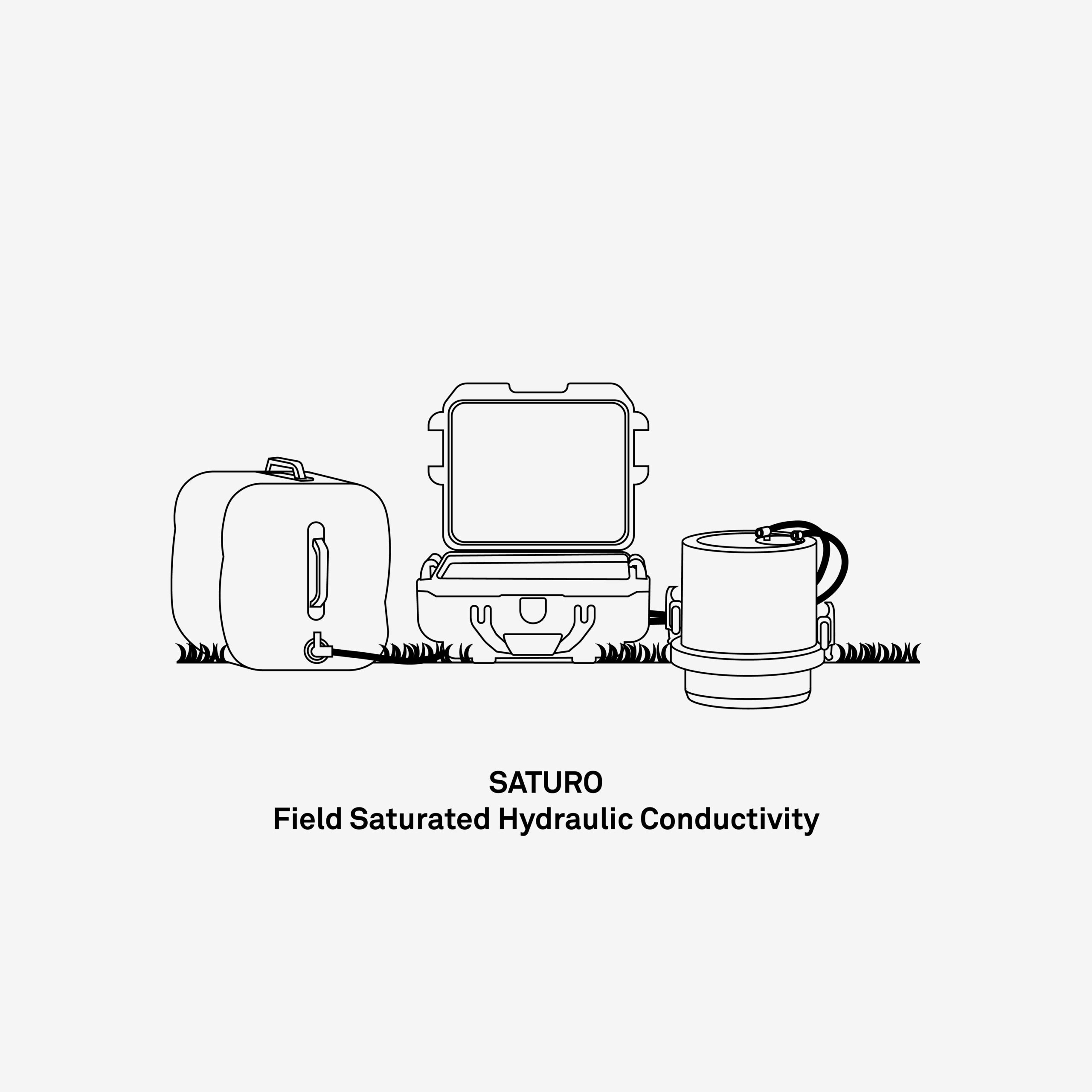
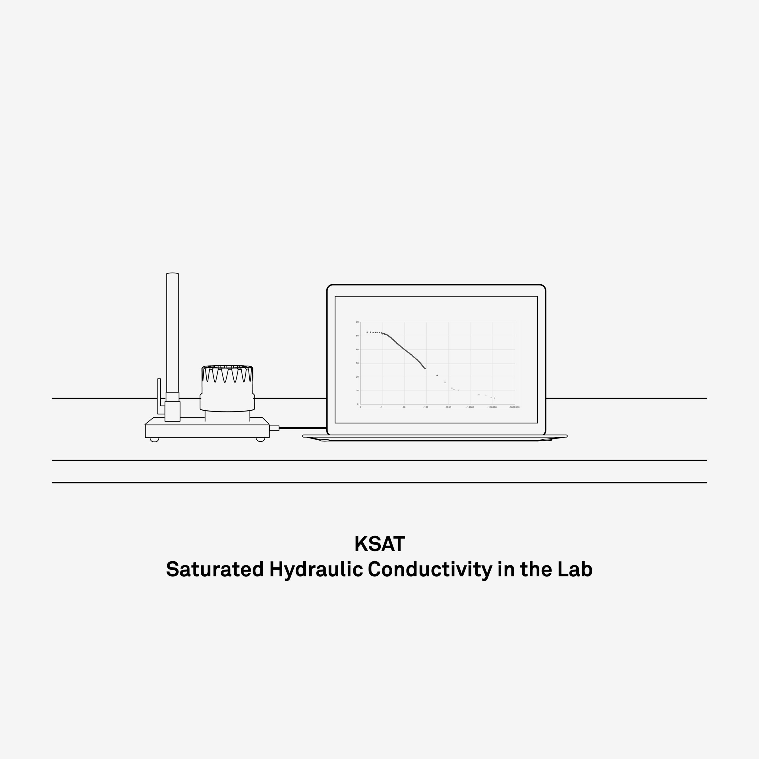
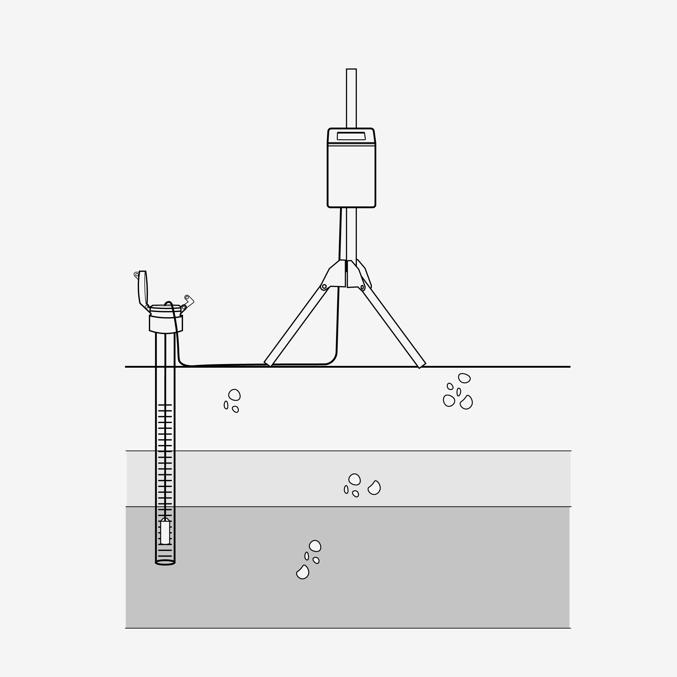
YOU ARE VIEWING THE STAGING SITE

Land reclamation

We know restoration isn’t just hard work—it’s high stakes. When you’re reclaiming land, every data point matters, and your measurements need to stand up to scrutiny. Whether you’re stabilizing disturbed sites, restoring ecosystems, or meeting regulatory milestones, you can’t afford delays, guesswork, or unreliable equipment. Success depends on accurate, continuous insight into soil and climate conditions—without excessive labor. METER’s research-grade soil moisture and atmospheric sensors are built for field durability and long-term precision. They streamline your monitoring workflows, reduce manual effort, and deliver the high-quality data you need to track recovery, validate performance, and move projects forward with confidence.

Infiltration

In land reclamation, the way water interacts with soil defines success. Measuring infiltration and saturated hydraulic conductivity (Ks) is essential for designing effective solutions, preventing runoff and erosion, meeting regulatory standards, and restoring function to damaged sites. METER’s automated lab and field instrumentation delivers the data you need—faster, more accurately, and with less manual effort—so you can make confident decisions and keep projects on track from initial assessment through long-term monitoring.

Soil moisture

To bring degraded land back to life, you need to understand how water is stored, held, and moves through the soil. Short- and long-term monitoring of volumetric water content (VWC) and soil suction (water potential) gives you that clarity. METER’s research-grade systems deliver accurate, continuous insight into soil moisture dynamics, so you can evaluate plant-available water, guide vegetation recovery, and ensure sustainable growth—all with less time in the field and more confidence in your data.

Measure the soil moisture profile at multiple depths using a single TEROS profile probe or multiple TEROS water content sensors, all connected to a cloud enabled data logger

Weather monitoring

You can’t restore what you don’t measure. Successful reclamation depends on knowing exactly what conditions your site is facing—not relying on weather data from miles away. Localized, accurate atmospheric monitoring is critical for planning, modeling, and long-term success. METER’s research-grade weather stations deliver the real-time, on-site data you need—temperature, humidity, rainfall, wind, solar radiation, and more—with the rugged durability to perform for years. So you can design smarter, maintain with precision, and document progress with confidence.

Saturated zone monitoring

What’s happening below the surface determines what’s possible above it. In reclamation projects, understanding the depth and dynamics of the saturated zone is critical to restoring ecosystems, managing water movement, and mitigating long-term risk. The HYDROS 21 does more than just measure the water table. It delivers three key data points—depth, temperature, and electrical conductivity—to give you a clearer picture of groundwater quality, salt intrusion, flow behavior, and ecological impact. Built for long-term deployment, it’s the tool you need to track subsurface change with precision—and reclaim land with confidence.

ZL6 Data Logger next to a tablet and several screenshots. the tablet and screenshots show data visualizations from ZENTRA Cloud software

ZENTRA System

Customize your data collection and logging solution by combining multiple METER sensors with the ZL6 Data Logger and ZENTRA Cloud. ZENTRA stores your data in the cloud, allowing easy access to your data and near-real-time reports from all of your data loggers.

Avoid costly field visits by accessing your data from any web-connected device. Analyze it with ZENTRA Cloud’s built-in visualization tools, and easily share insights without tracking down log files on individual computers.

Learn more about ZENTRA

LABROS System

Streamline your laboratory analyses and reduce human error using the innovative LABROS soil science laboratory collection. Perform automated particle size analysis, generate soil moisture release curves, or measure thermal and hydraulic conductivity with METER laboratory instruments designed to produce accurate analyses in a fraction of the time of other methods.

Even better, LABROS instruments can be combined to perform all of these analyses from a single sample, saving time and reducing measurement errors due to variations in sample characteristics.

See LABROS products

LABROS-capable laboratory instruments from METER, including WP4C, KSAT, VARIOS, and PARIO

JP_Fukushima_Invisible_059
"When the tsunami hit the Fukushima nuclear power plant, radioactive material was released. Together with METER, a new method was developed to decontaminate the soil while leaving it fertile."
Department Head of Global Agriculture Sciences Professor Masaru Mizoguchi | The University of Tokyo

Read the case study
See how scientists, growers, and engineers have used METER solutions in the field.
Episode 20: The impact of seasonal vegetation on coastal dune storm recovery

Episode 20: The impact of seasonal vegetation on coastal dune storm recovery

Oklahoma switchgrass: How deeper root systems affect groundwater recharge and the water cycle

Oklahoma switchgrass: How deeper root systems affect groundwater recharge and the water cycle

Can wastewater save the United Arab Emirates’ groundwater?

Can wastewater save the United Arab Emirates’ groundwater?

A photo of a METER publication in book form open on a flat surface

Case studies, webinars, and articles you’ll love

Receive the latest content on a regular basis.

icon-angle icon-bars icon-times