YOU ARE VIEWING THE STAGING SITE

Slope and embankment stability

We know what’s at stake when you're monitoring unstable slopes—because when failure hits, it's not just infrastructure on the line. Early warnings save lives, protect budgets, and give teams the time they need to act. When slope failure is a risk, accurate, real-time data from the unsaturated zone can mean the difference between proactive mitigation and catastrophic loss. METER’s precision soil moisture and soil suction sensors are built on decades of published research and engineered for long-term deployment in harsh conditions. With ZENTRA Cloud, you can access and share data from any site—giving you and your team near-real-time visibility into slope conditions, no matter where you are.

Unsaturated zone monitoring

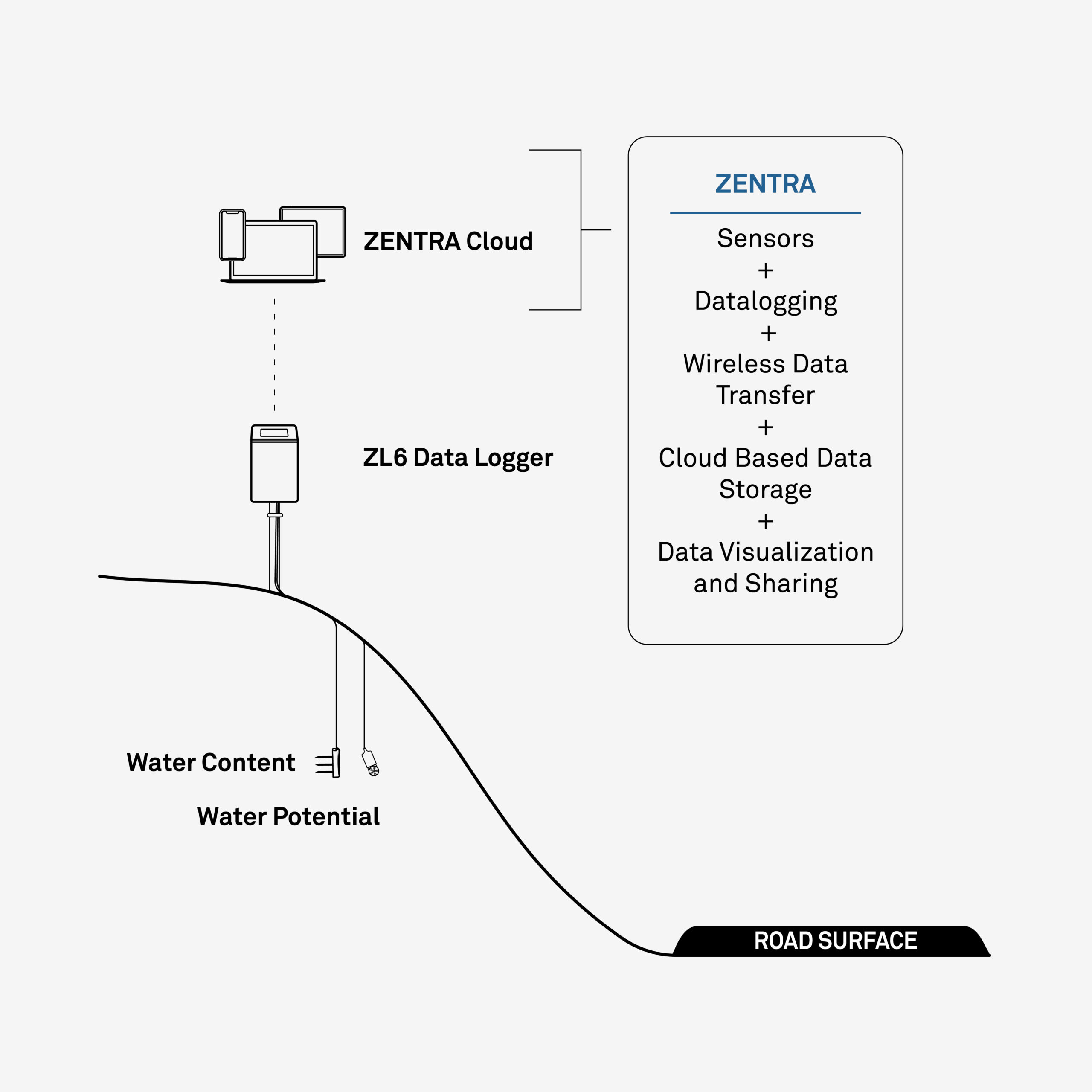
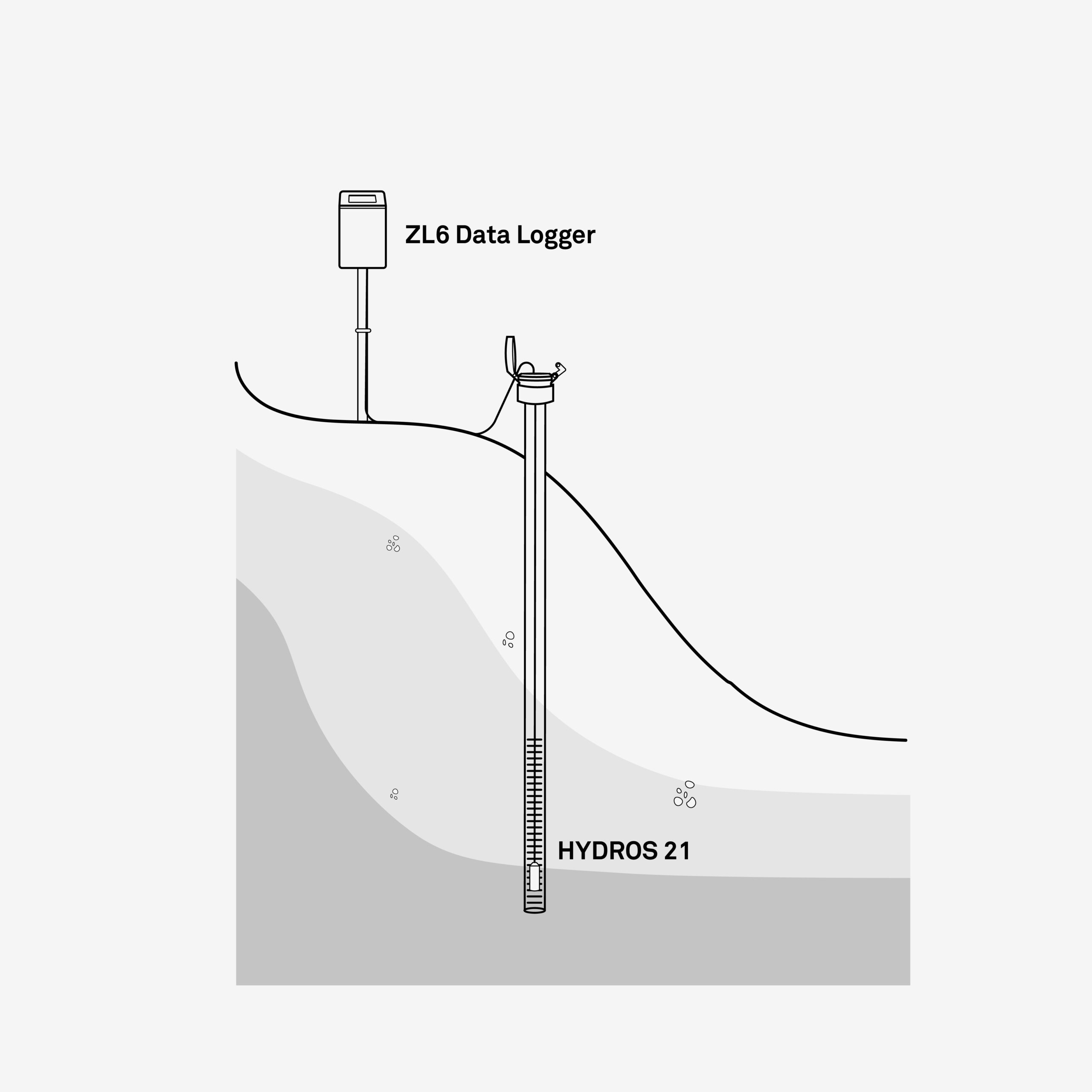
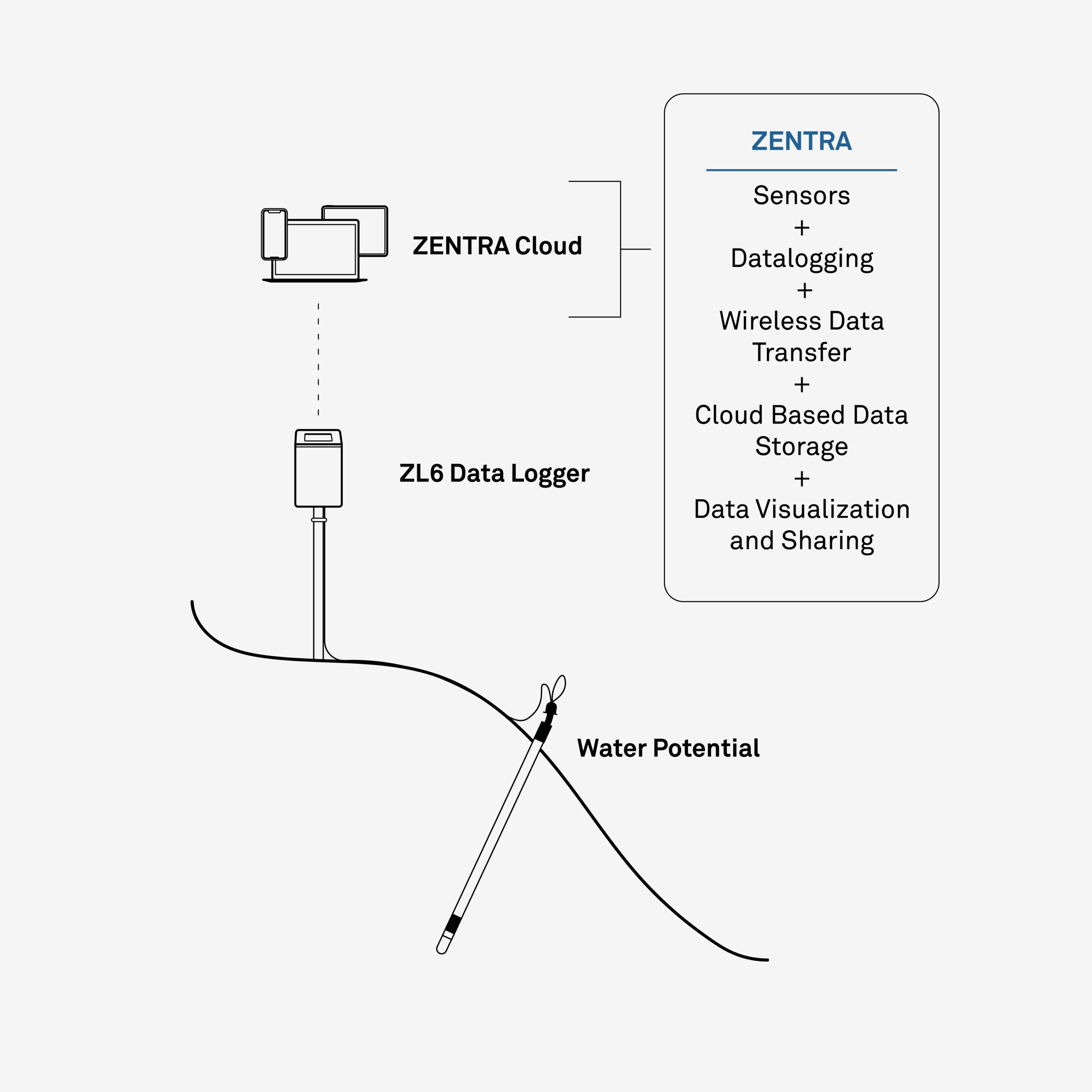
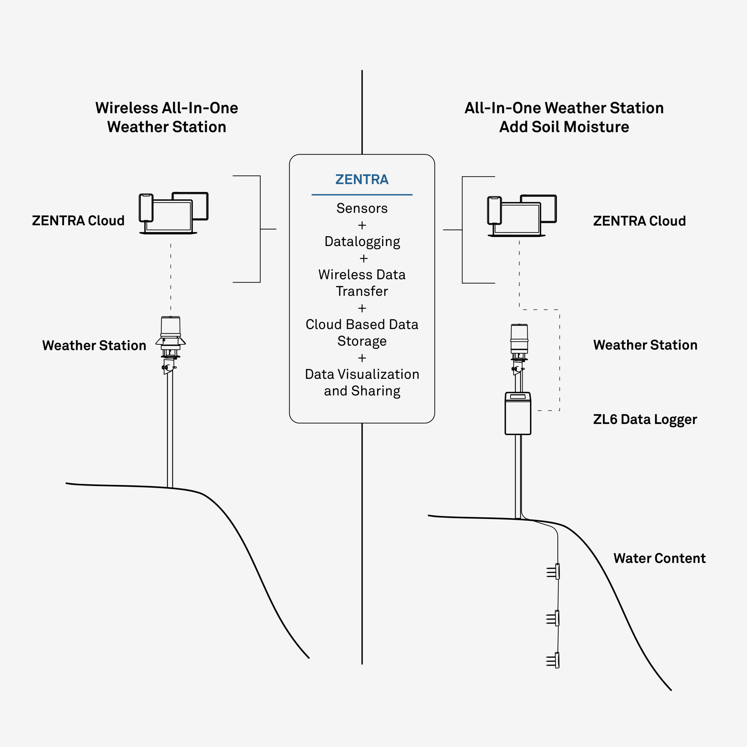
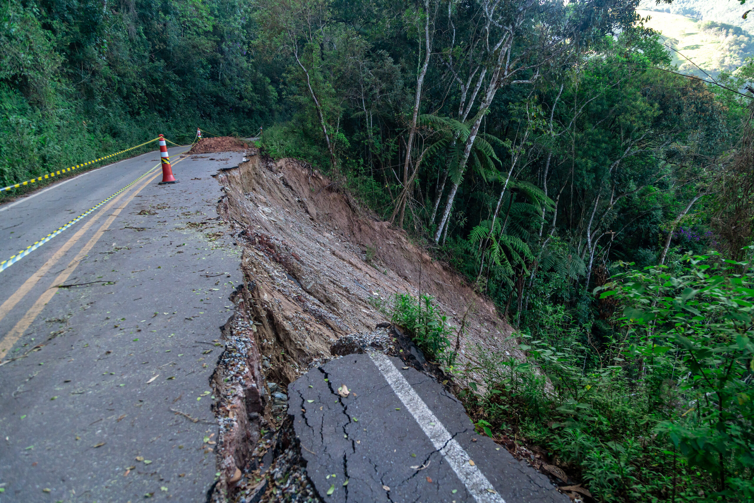
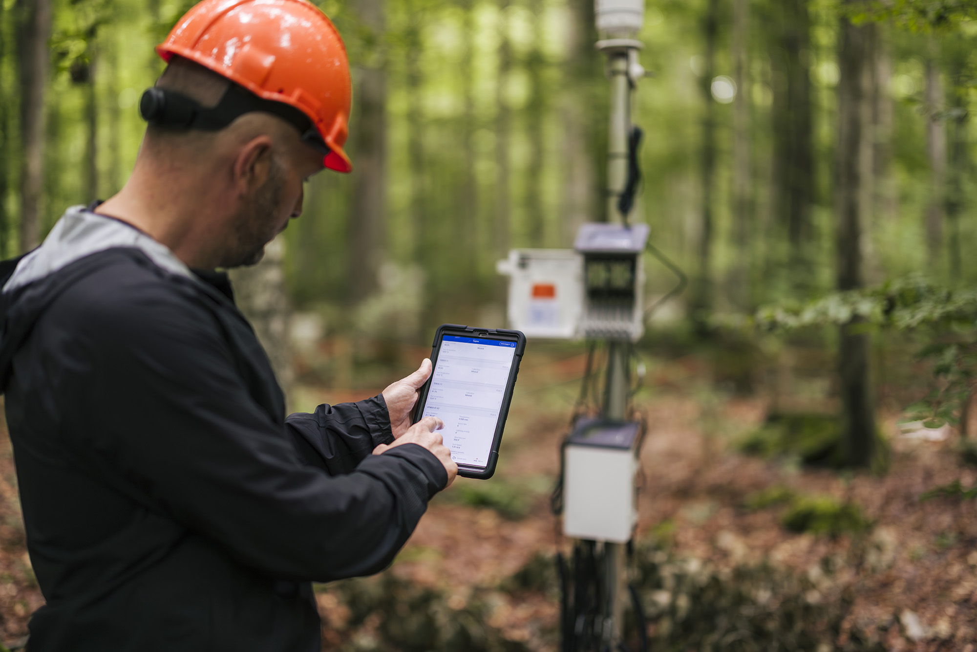
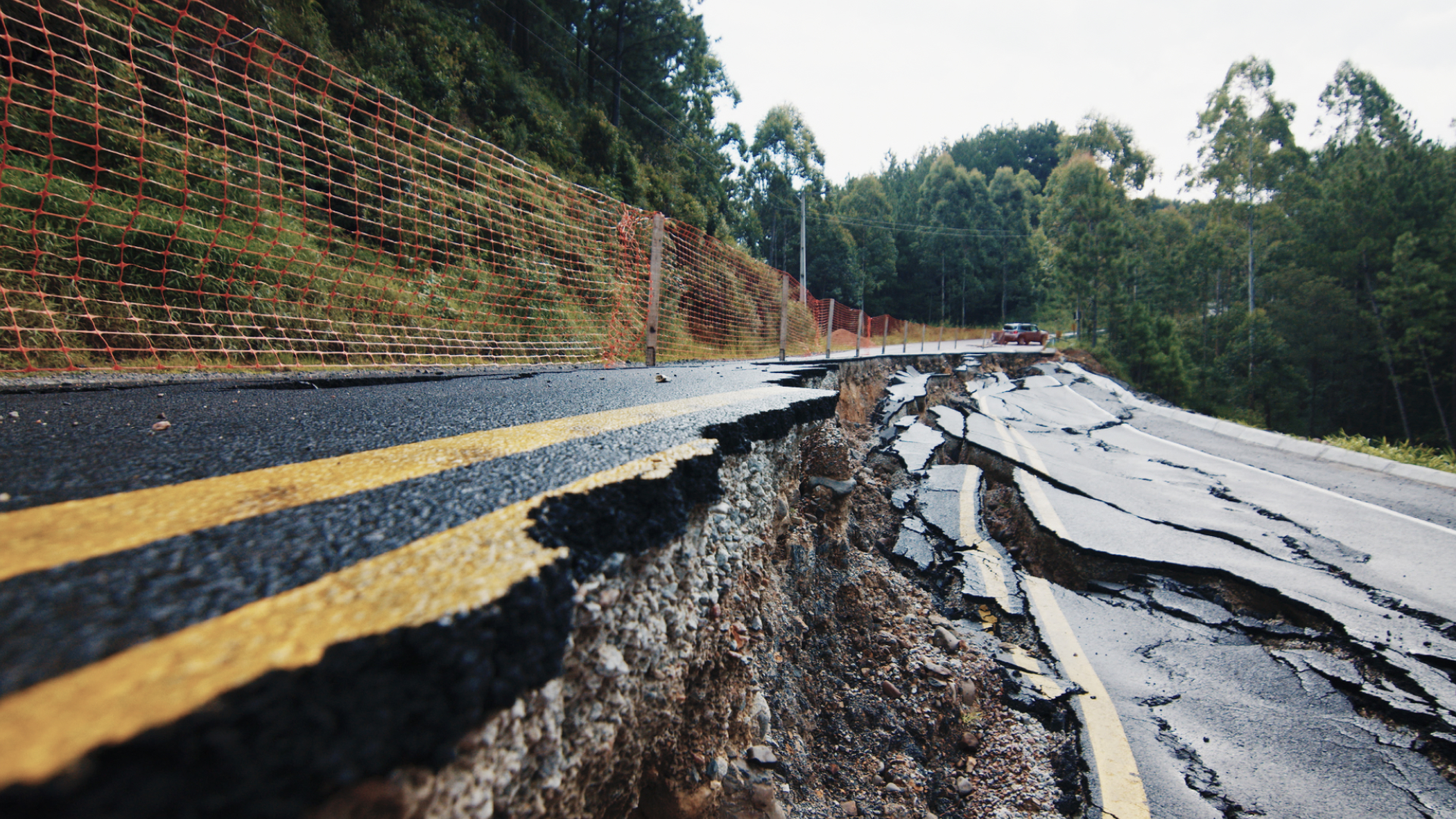
When slopes move unexpectedly, the consequences are measured in lives, liability, and long-term damage. That’s why real insight starts with continuous, on-site monitoring of the unsaturated zone—not distant estimates or delayed alerts. METER delivers research-grade data on local precipitation, soil moisture retention, soil temperature, and air temperature, so you can detect instability early, reduce uncertainty, and make informed decisions with confidence—right where the risk lives.

Saturated zone monitoring

Elevated saturation levels increase pore water pressure, reduce soil cohesion, and raise the risk of slope failure. For engineers, waiting to react isn't an option—not when lives, infrastructure, and liability are on the line. METER’s monitoring systems deliver continuous, research-grade measurements of the saturated zone, giving you real-time insight into changing site conditions. With accurate data on precipitation, infiltration, and subsurface water movement, you can take proactive steps to preserve slope stability and prevent disaster—before it begins.

Weather monitoring

Temperature swings, wind, and humidity drive erosion, saturation, and instability—and when conditions change fast, you need local data you can trust. METER’s weather monitoring solutions provide continuous, site-specific measurements of atmospheric conditions—including temperature, humidity, wind speed, and rainfall—paired with soil moisture insights to help you detect erosion risk and predict slope failure before it happens. Protect lives and infrastructure with the foresight that only real-time, research-grade data can deliver.

Groundwater level

When groundwater rises, so does the risk. Elevated groundwater levels increase pore water pressure, reduce soil strength, and can trigger slope and embankment failure. For engineers, real-time visibility into subsurface conditions is critical to preventing disaster. METER’s systems deliver continuous, research-grade groundwater level measurements, giving you the data you need to monitor pressure buildup, assess changing site stability, and take timely action to protect infrastructure and lives.

ZL6 Data Logger next to a tablet and several screenshots. the tablet and screenshots show data visualizations from ZENTRA Cloud software

ZENTRA System

Customize your data collection and logging solution by combining multiple METER sensors with the ZL6 Data Logger and ZENTRA Cloud. ZENTRA stores your data in the cloud, allowing easy access to your data and near-real-time reports from all of your data loggers.

Avoid costly field visits by accessing your data from any web-connected device. Analyze it with ZENTRA Cloud’s built-in visualization tools, and easily share insights without tracking down log files on individual computers.

Learn more about ZENTRA

“What we’re doing with our monitoring stations is not super complicated. It involves a plan of what you want to get out of it. The same method could be applied anywhere, really.”

 – Stephen Hughes, PhD, Professor of Geology | University of Puerto Rico, Mayagüez

Listen to the podcast

See how scientists, growers, and engineers have used METER solutions in the field.
Episode 36: The 70,000-landslide storm

Episode 36: The 70,000-landslide storm

The staggering cost of Montana’s flash drought

The staggering cost of Montana’s flash drought

Episode 32: How to predict landslides

Episode 32: How to predict landslides

A photo of a METER publication in book form open on a flat surface

Case studies, webinars, and articles you’ll love

Receive the latest content on a regular basis.

icon-angle icon-bars icon-times